The structure of Mt Merapi
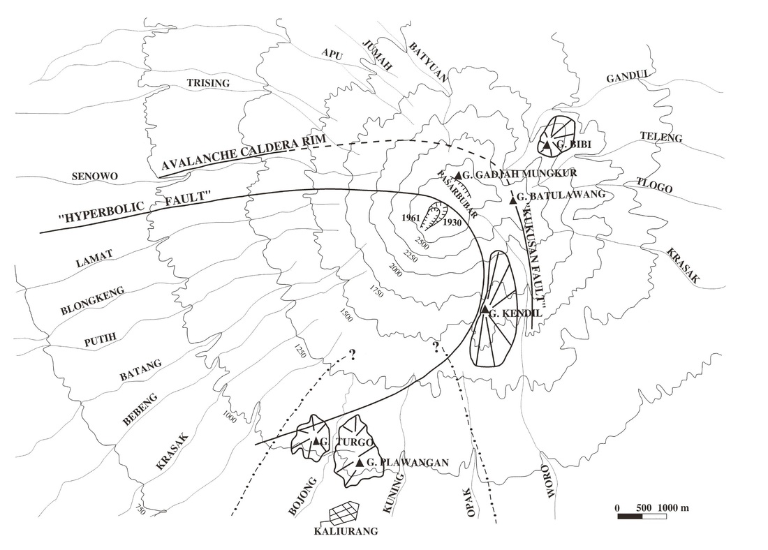
Figure 6: Map from Camus et al. (2000) illustrating important structural features of Mt Merapi.
Morphological evolution
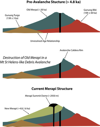
Merapi lies on top of two ancient volcanic edifices: Gunung Bibi and Gunung Turgo/Palawangan. Revised age dating (Gertisser et al., 2012; Figure 7) for these edifices exhibit significant overlap. Some authors, however, favor Gunung Bibi as the oldest volcanic feature (e.g. Camus et al., 2000), which can be seen on the NE flank of Merapi extending ~250m above recent volcanics. These ancient volcanic structures are overlain by "Old Merapi", which consists of deposits of the Batulawang and Gadjah Mungkur series (Camus et al., 2000). Recent dating has constrained these deposits to a period between 4.8 and 30 ka (Gertisser et al., 2012; Figure 8).
The New Merapi period began between 4.8 and 1.6 ka, when a large sector collapse destroyed a significant portion of the Old Merapi edifice. The Kukusan fault (Figure 6) represent the avalanche caldera rim that resulted from this event. Since this time, volcanic activity (e.g. pyroclastic flows and lahars) has been primarily confined to the to the SW quadrant of the volcano, because the caldera rim forms an arcuate ridge that effectively blocks laterally moving currents.
The New Merapi period began between 4.8 and 1.6 ka, when a large sector collapse destroyed a significant portion of the Old Merapi edifice. The Kukusan fault (Figure 6) represent the avalanche caldera rim that resulted from this event. Since this time, volcanic activity (e.g. pyroclastic flows and lahars) has been primarily confined to the to the SW quadrant of the volcano, because the caldera rim forms an arcuate ridge that effectively blocks laterally moving currents.
Figure 7: Evolution of Mt Merapi from Old Merapi (top) to New Merapi (bottom). Modified from Camus et al. (2000).
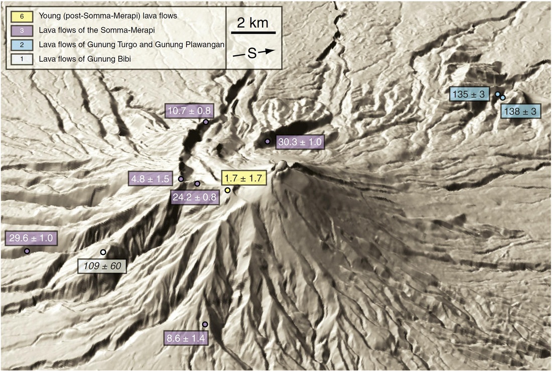
Figure 8: DEM image of Mt Merapi viewed from the west with the locations of recent Ar-Ar and K-Ar dates. Figure from Gertisser et al. (2012).
